I have arranged to meet up with Charley in a traditional eatery close to the Plaza de Armas, in the centre of the old spanish city. I am early, so I browse through the tourist shops, with their brightly coloured cloths, engraved gourds, bordaderos, embroideries from Ayacuchos, the sunhats, tiny llamas carved in soapstone, painted ceramic bulls,
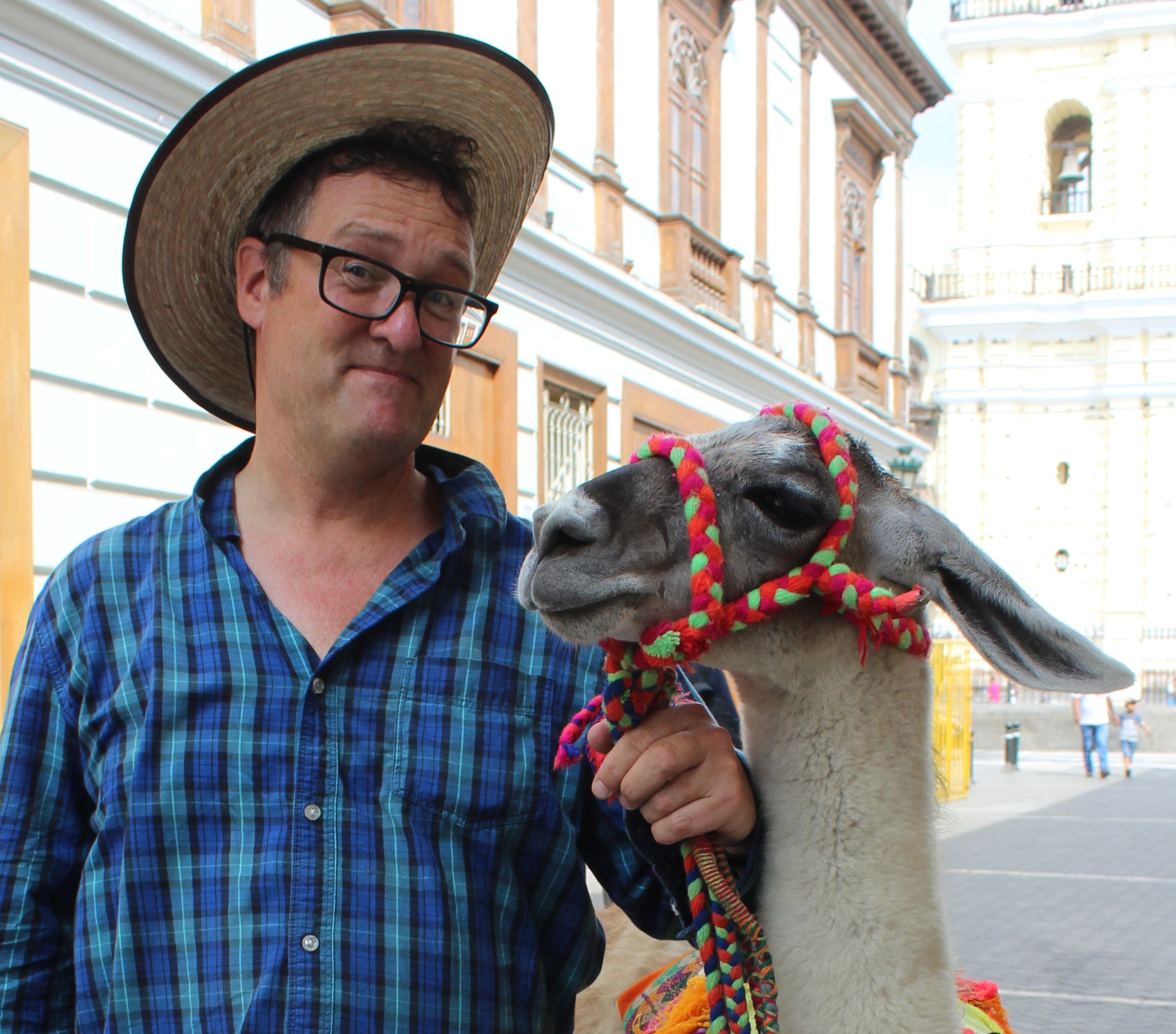
On the street outside a woman is standing with a llama. “What is she called?” I ask.
“She is Rosita.”
Rosita looks at me, licks her lips, and hums.
And how do you bring her here?”
“In a taxi,” the lady smiles.
It is an enchanting vision, and so for ten soles I have my photograph taken with Rosita.
I find Charley inside Cordanos, seated at a simple wooden table. He is, as usual, dressed like an archaeologist, with field boots and a khaki waistcoat with many pockets. His battered sun hat sits on the table.
We order a couple of beers and the rolls of thick ham and sweet onion that are a long-standing tradition here.
On the walls are photos of eminent visitors – several Peruvian presidents, a couple of US presidents, and various film stars and footballers, including Jennifer Lopez and Pele. But then the Restaurante Cordano is located beside the Presidential Palace.
I outline to Charley what I have been doing over the past few months, since I visited the dig site at Cerro d’Oro.
“I am intrigued by the Andean vision of the night sky,” I conclude, “and whether particular dates or alignments might relate to the images on the stones. But I know this is a massively complex area. I was hoping you could give me a brief archaeologist’s overview?”
“Yessir. There is a lot of speculation, and a lot of hot air. It is tough to prove that alignments of a site are significant. Even tougher to prove they are not. It is complex and at times controversial.”
I nod.
“There are alignments all over south, central and even north America. No doubt about that. People in New Mexico a thousand years ago seemed to align with a position of the moon, 53 degrees east of north. The Maya built cites at Chichen Itza, Uxmal, Kabah, pointing somewhere east of north. “
“And in South America, in Peru?” I ask.
“There is a U-shaped mound at El Paraiso, in fields on the northern edge of modern Lima, that dates to 4000 years BP. It is said to be orientated at 25 degrees east of north. That was the earliest. These U-shaped ceremonial centres, are found up four valleys – the Chancay, the Chillon, the Rimac, the Lurin. They date to between 4000 and 3000 BP. And they all point somewhere east of north.”
“And the Inca, of course, built Macchu Pichu in alignment with the stars or the sun?”
“Sure. Stones at Machu Picchu, together with many Inca carved stones and huacas around Cusco, have important alignments. The main Cusco temple, the Coricancha, had separate rooms dedicated to the Moon, to Venus, to the Pleiades and all the stars, to lightning and thunder, and to the rainbow. The Inca marked the solstices from Cusco by eight towers, four to the east and four to the west. They measured the equinoxes by observing the east-west shadow from a stone column. We know plenty about the Inca.”
“And what about the mounds at Maranga, round the zoo and San Marcos?”
“The Lima mounds which date to 1400-1900 years BP, are oriented 26 degrees east of north. The Ychsma buildings, built 900 years later a little to the west, are around 18 degrees east of north. No-one knows why.”
“No-one knows why?” I question. “After all this time? How come?”
“Lots of people have proposed explanations. There are plenty of ideas out there.”
” I have a few myself” I replied.
“Well, join the gang. The Peruvian coast runs at an angle from the border with Ecuador, down to Ica, on a bearing of 150 degrees. Turn through a right angle, and you are looking up at the mountains.”
“Sixty degrees east of north,” I said.
Exactly. You are looking up at the Andes, often you are looking up the river valleys, and you are looking at the rising of the Pleiades, the summer solstice, moon alignments and who knows what else.”
“Or at all of them together?”
“It could be. And I have just realised that the aligned sites I know of are all on the north and central coast. Is there nothing to the south, once the coastline bends after Ica? That’s an interesting thought!”
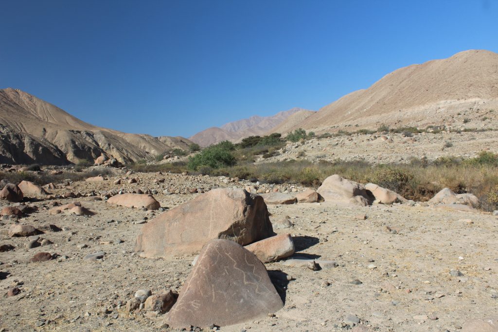
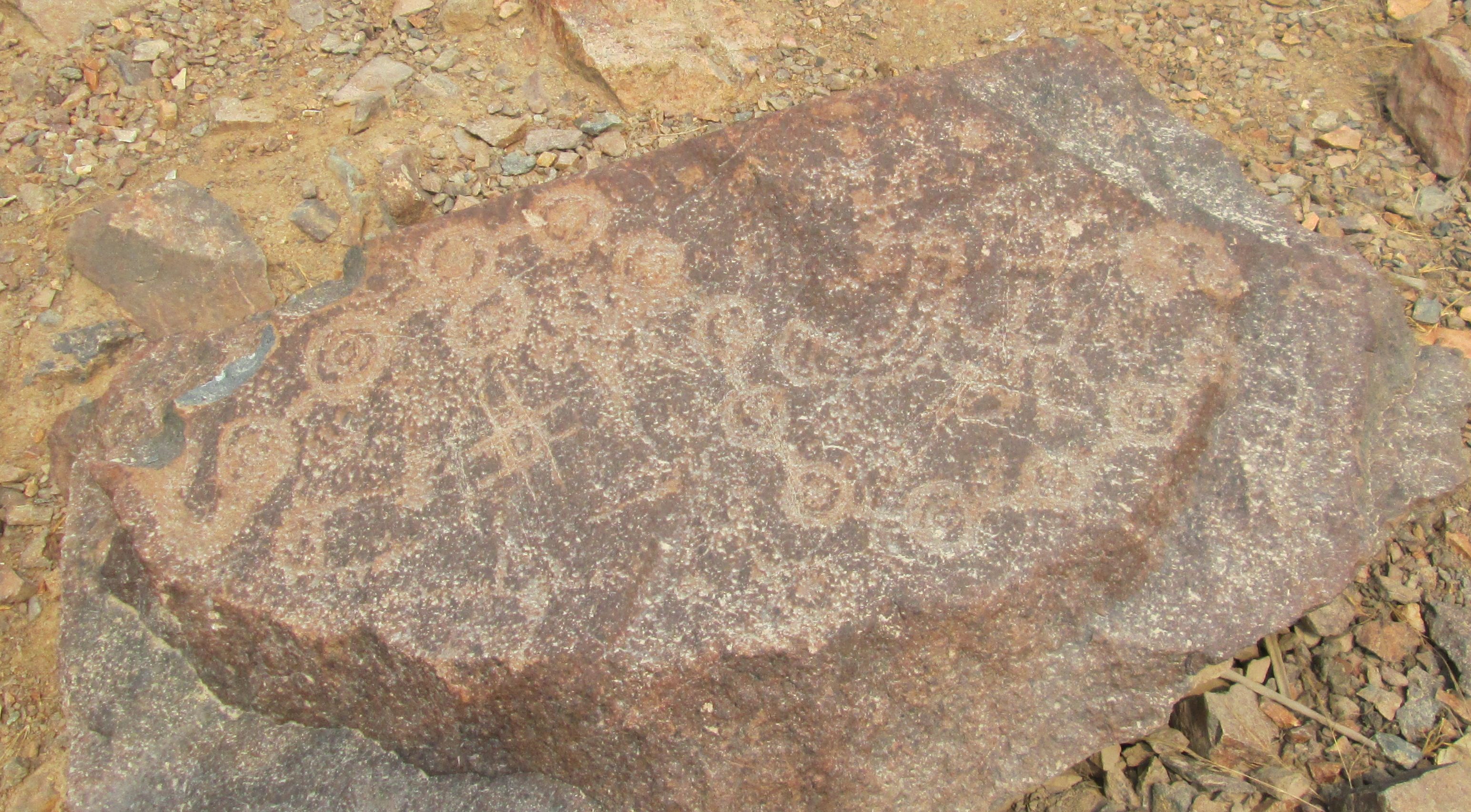
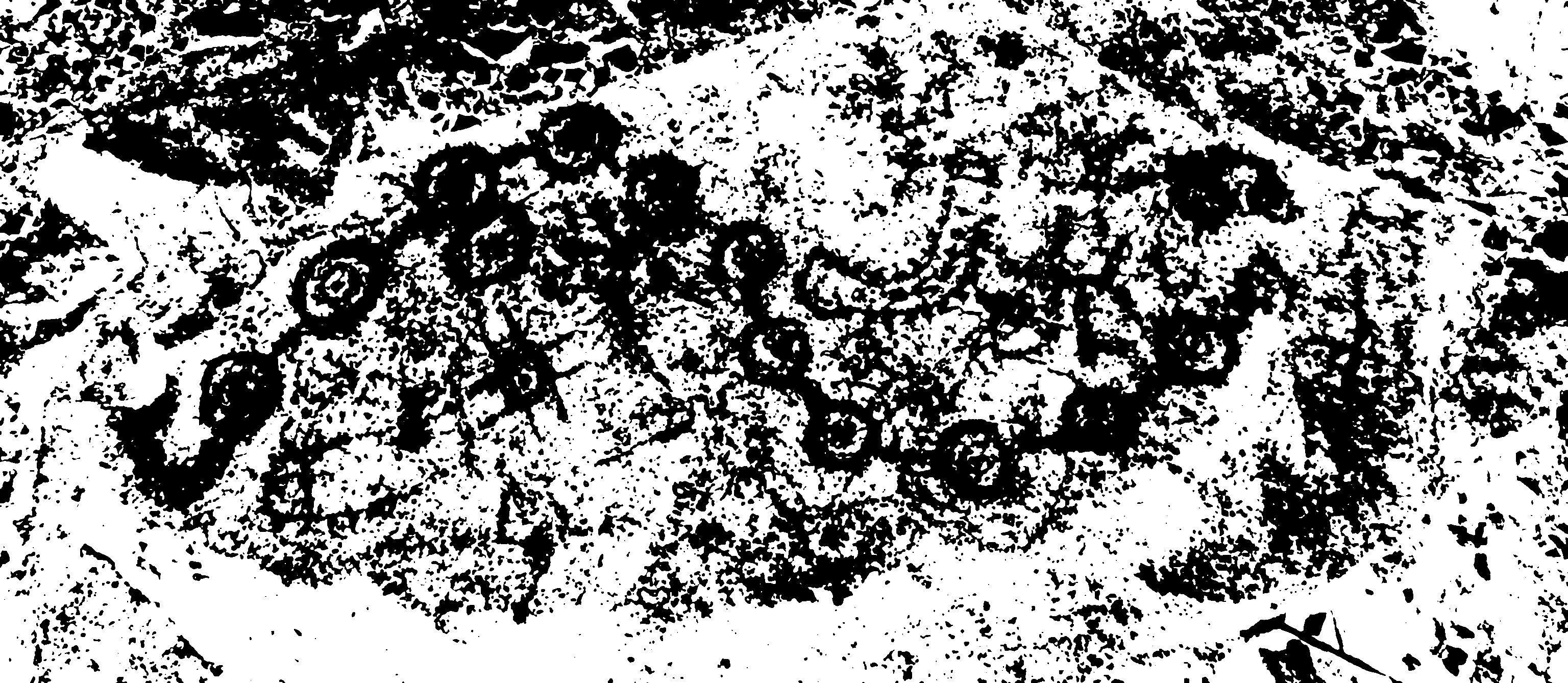
“Do you know Miculla?” I ask. “It is a plain of boulders with a dark brown patina up the river valley from Tacna. There are beautiful petroglyphs on the stones, cutting through the patina to yellow or grey rock below.”
“I did some fieldwork there,” Charley replies.
“I took a bus out from Tacna a few years ago, I spent most of the day criss-crossing the plain, wandering from rock to rock, photographing their dancing figures, llamas, birds, and serpents. Higher up the plain, where a seasonal stream emerges from a narrow valley, I find a lady selling ices. I raise my head and look up the valley. And I see a couple of snow capped mountains, neatly framed between the hillsides of the narrow valley.”
“Yes, I saw the same,” Charley replies. “Standing in desert, under a hot sun and bright blue skies, looking inland to snow-capped mountains. Special.”
“The ice cream seller told me they are visible most days, especially in the winter. I found they were two 6000 m high volcanic peaks 50 km away, on a bearing of about 60 degrees east of north.”
“Yay. Volcanic cones, just like Mexico.”
“After seeing that, I walked back down the valley, and It seemed that many of the upstanding rocks mirror the hillsides, and the drawings are framed to be seen from below, with the mountains providing a background to the stones. Many of the rocks are marked with a figure with outstretched hands from which serpentine streams of water flow.”
“”The lord of the waters”, he has been called,” says Charley, “but again, there are multiple interpretations.”
“I am thinking the plain of Miculla would be a fine setting to watch the Pleiades rise above snowy peaks as the culmination of a June festival for the start of the year,” I say.
“It would indeed. But it is all speculation. However, at Chankillo, the evidence is pretty conclusive.”
“Chankillo, the Sechin site?”
“That’s the one. Thirteen regularly spaced rectangular towers run the length of a 300-metre ridge like a spine. From below, they look like a line of prehistoric teeth outlined against the sky, behind which the sun rises or sets. Like any line of towers running roughly north to south, they could have been used to observe sunset. “
“I have heard that they are calling it is the oldest solar observatory in the Americas,” I say.
“It is pretty solid that they were a foresight on the sunrise 2300 years ago. There is a narrow passage leading to an doorway with a view of the towers, looking east. Close to the door and along the passage there were ritual offerings, broken ceramics and spondylus shells.”
“So what exactly were they looking at?”
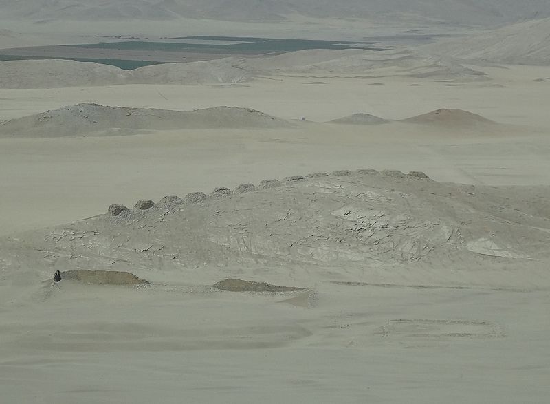
“The Sun appears for one or two days in each gap between towers, taking six months to go from one end of the structure to the other. The different towers divide the year into regular intervals of ten to fifteen days. The two ends of the line of towers mark the solstices.”
“Wait! Thirteen towers. I saw a petroglyph at Checta, that seemed to represent something similar.”
I search through the images stored on my phone.
“Here. It is a flat stone showing thirteen or fourteen points in an undulating line.”
I show Charley the photograph.
“What do you think?”
He looks at it cautiously.
“I am generally doubtful about archaeoastronomy claims,” he replies.
“On the left hand,” I point out, “is a rayed circle that could represent the sun, and a crescent on the right that could represent the moon.”
“Yes, but the stone, laid flat on the ground, is not a marker,” says Charley. “It could represent the concept of the annual solar cycle, I’ll say that.”
“You are sceptical. OK. But we have Chankillo, a construction to observe sunrise and sunset across the year. The U-shaped mounds in the valleys around Lima are oriented towards the mountains, up the valleys, and possibly towards celestial markers. The Inca held rituals to recognise the sun at the solstice and the equinoxes, and built a temple to Venus and the Pleiades. Location within the landscape of the sky has been embedded in South American thought for five thousand years. So I think it is worth asking the question: could the stones at Cochineros and the markings on them have some relationship with the sun or the stars?”
“You should read Gary Urton,” Charley advises.