I have arranged to meet up with Charley in a traditional eatery close to the Plaza de Armas, in the centre of the old spanish city. I am early, so I browse through the tourist shops, with their brightly coloured cloths, engraved gourds, bordaderos, embroideries from Ayacuchos, the sunhats, tiny llamas carved in soapstone, painted ceramic bulls,
On the street outside a woman standing is with a golden-brown llama, with bright red tassels hanging from her ears.
“What is she called?” I ask.
“She is Rosita.”
Rosita looks at me, licks her lips, and hums.
And how do you bring her here?”
“In a taxi,” the lady smiles, and so I have my photograph taken with Rosita.
“You should read Gary Urton,” Charley advises.
We order a couple of beers and the rolls of ham and sweet onion that are a long-standing tradition. On the walls are photos of eminent visitors – several Peruvian presidents, a couple of US presidents, and various film stars and footballers, including Jennifer Lopez and Pele.
But then, the Restaurante Cordano is located beside the Presidential Palace.
Bottles of beer are placed on the table and I outline to Charley what I have been doing over the past few months, since I visited the dig site at Cerro d’Oro.
“I am intrigued by the Andean vision of the night sky,” I concluded, “and whether particular dates or alignments might relate to the images on the stones. But I know this is a massively complex area. I was hoping you could give me a brief archaeologist’s overview?”
“Yessir. There is a lot of speculation, and a lot of hot air. It is tough to prove that alignments of a site are significant. Even tougher to prove they are not. It is complex and at times controversial.”
I nodded.
“There are alignments all over south, central and even north America. No doubt about that. People in New Mexico a thousand years ago seemed to align with a position of the moon, 53 degrees east of north. The Maya built cites at Chichen Itza, Uxmal, Kabah, pointing somewhere east of north. “
“And in South America, in Peru?” I ask.
“There is a U-shaped mound at El Paraiso, in fields on the northern edge of modern Lima, that dates to 4000 years BP. It is said to be orientated at 25 degrees east of north. That was the earliest. These U-shaped ceremonial centres, are found up four valleys – the Chancay, the Chillon, the Rimac, the Lurin. They date to between 4000 and 3000 BP. And they all point somewhere east of north.”
In coastal Peru, something similar is found. Cardal, the U-shaped mound in the Lurin valley, a few hundred metres from the tall round hill known as Pan d’Azucar, and the spring of eternal youth at its foot, is oriented with the mouth of the U pointing about 16 degrees east of north. The U mound at Manchay Bajo, two kilometres away across the valley, is aligned 30 degrees east of north while a third mound, four kilometres to the south, Mina Perdida, is around 23 degrees east of north.
There are seven such mounds in the valley, dating from 3800 to 2800 years before the present. The open face of the U mounds point up the valley, parallel to the river, or towards the night sky, the visible horizon between steep hills. There are more of these U-shaped mounds in the Rimac, Chillon and Chancay valleys to the north, twenty in all. All the complexes are oriented between 13 and 64 degrees east of north, with 13 of 20 oriented between 30 and 65 degrees east of north.
Standing stones and stone circles began to be assessed from a new perspective, in relation to the movements of the sun and moon and stars, in the 1960s. Solstices, when the sun reaches the extreme of its journey north (or south), and begins to return to the centre, were considered to be particularly significant.
Archaeo-astronomy, as it came to be known, led to a re-investigation of many well known sites and an extra perspective on many new sites.
Sites such as Stonehenge, Carnac and Newgrange in Europe were suddenly reassessed and found to contain astronomical markers of extraordinary precision. The pyramids of Giza in Egypt, Chichen Icha and Uxmal in Mayan Yucatan, and the roads, windows and rock carvings of Chaco Canyon in New Mexico were similarly re-examined and re-interpreted.
The buildings at Maranga, near today’s Lima zoo, also have consistent alignments. The earliest, the Lima culture buildings to the east of the zoo which date to 1400-1900 years BP, are oriented 26 degrees east of north. The Ychsma buildings, built 900 years later a little to the west, are around 18 degrees east of north. No-one knows why.
Whatever the reason for this pattern, it is not coincidence. The orientation of buildings in space by Andean cultures, their alignment with the universe, has an early beginning.
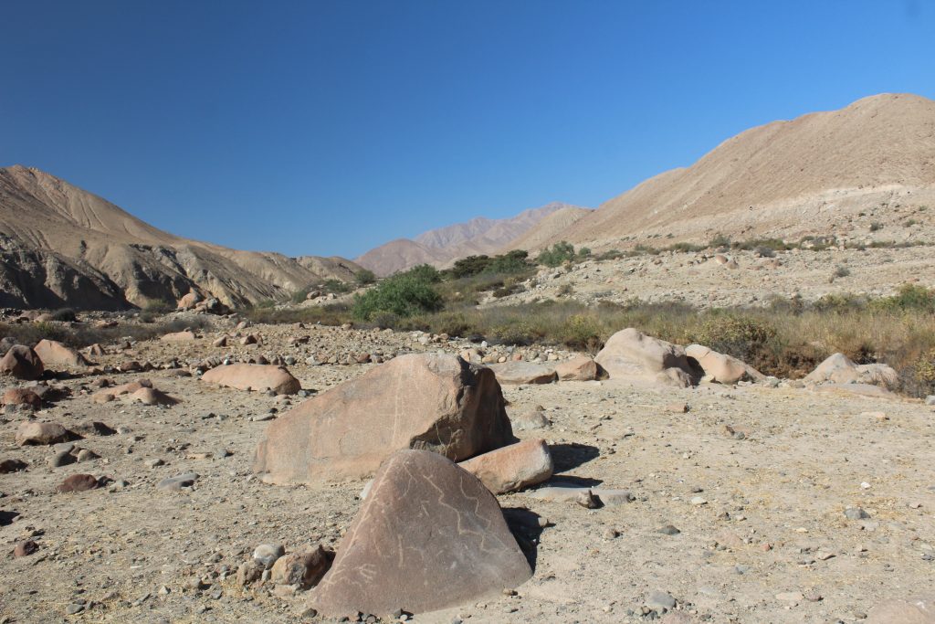
Other rock art sites give up their secrets more easily. Miculla is a plain of boulders with a dark brown patina up the river valley from Tacna on the border of Peru with Chile. For several kilometres along the valley, and a kilometre or more across the plain, there are drawings on the stones, cutting through the patina to yellow or grey rock below.
Taking a bus out from Tacna, I spend most of the day criss-crossing the plain, wandering from rock to rock, photographing their dancing figures, llamas, birds, and serpents. Higher up the plain, where a seasonal stream emerges from a narrow valley, I find a lady selling ices. She waits in this remote spot because twice a day, in the morning and the afternoon, coaches disgorge their visitors in the car park here, to view a few token stones before returning to the city. As I wipe my face and peel off the wrapper on the ice-cream, I raise my head for the first time that day and look up the valley. “Is that snow!” I exclaim. Far in the distance are what appear to be a couple of snow capped mountains, neatly framed between the hillsides of the narrow valley.
“Si hay,” she says, “they are.” They are visible most days, she tells me, especially in the winter.
They are the volcanic peaks of Tacora, at 5980 metres, and its twin Chupiquiña, 49 kilometres away, I later discover, on a bearing of about 60 degrees. It seems to add significance to this otherwise barren plain: many of the rocks are marked with imaginary watercourses, or a figure dubbed “the lord of the waters”, with outstretched hands from which serpentine streams of water flow; walking back down the plain, I turn to see how upstanding rocks mirror the hillsides, and drawings are framed to be seen from below, with the mountains providing a background to the stones. It would be a fine setting to watch the Pleiades rise above snowy peaks as the culmination of a June festival for the start of the year.
In 2007, a coastal site in Peru dating to the Early Horizon or Formative Period was identified as probably the oldest solar observatory in the Americas. The ceremonial site provides evidence of detailed solar observation throughout the year as early as 2300 years ago, long before the Incas.
The Chankillo site has been known to archaeologists since the nineteenth century. Two round towers on a hilltop within a double walled enclosure resemble a fortress, but the line of towers to the east is more interesting. These are solid constructions of masonry without interior rooms or spaces, but with staircases up either side.
Thirteen regularly spaced rectangular towers run the length of a 300-metre ridge like a spine, creating an artificial horizon from some vantage points. Like any line of towers running roughly north to south, they could have been used to observe sunset. From vantage points below, they look like a line of prehistoric teeth outlined against the sky, behind which the sun rises or sets.
In 2007 a team excavating ruins to the west of the site discovered a narrow passage leading to nothing but an open doorway with a view of the towers, looking towards the rising sun. Close to the doorway and along the passage the team found evidence of ritual offerings, broken ceramics and spondylus shells. The narrow passage suggests that only a small elite attended these ritual views of the sunset.
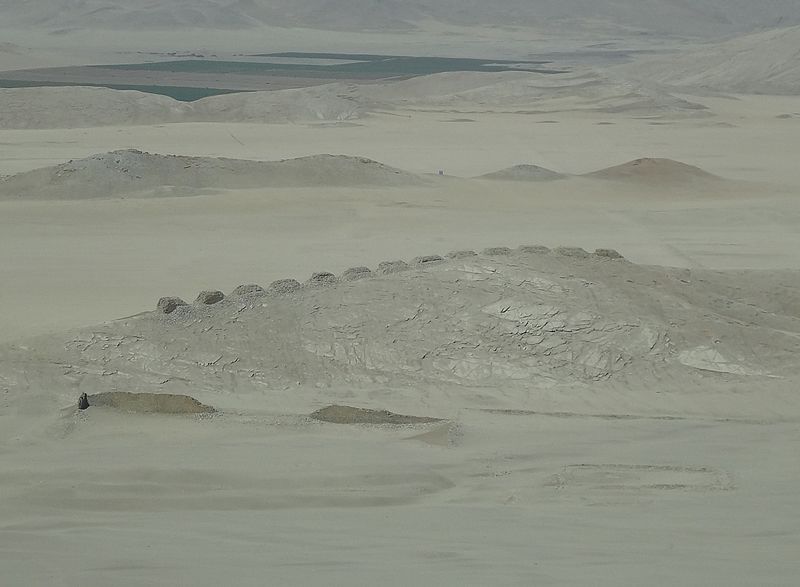
The thirteen towers precisely span the solar year. On the summer solstice, the Sun viewed from the passage rises between Tower 1 and a nearby mountain, Cerro Mucho Malo, and on the winter solstice, the Sun rises around Tower 13. The Sun appears for only one or two days in each gap between towers, taking six months to go from one end of the structure to the other. The different towers divide the year into regular intervals of ten to fifteen days.
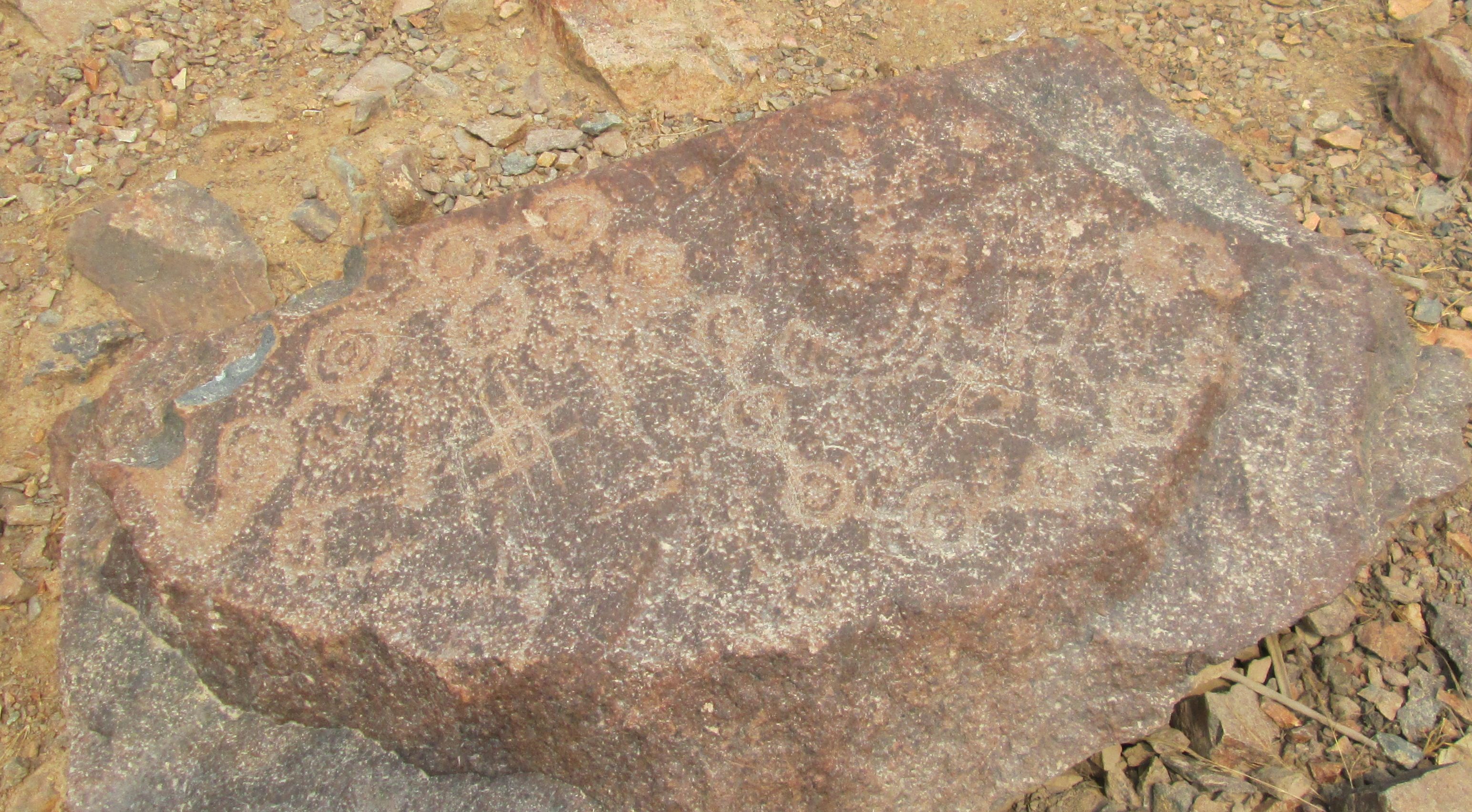
At Checta, another theatrical site on a shoulder of hillside north of Lima, with a fine view due west down the valley towards the sunset, There is a flat stone showing a succession of thirteen or fourteen points in an undulating line, a visual representation of the sun’s movements from equinox through solstice and back. On the left hand side is a rayed circle that could represent the sun, and a crescent on the right that could represent the moon. The stone, laid flat on the ground, is not a marker, but it seems to be expressing the concept of the annual solar cycles, an explanation of Chankillo.
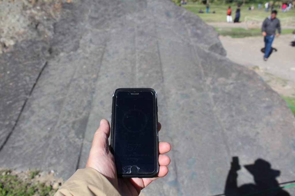
In the Andean world of the Incas, horizon alignments and sun shadows were an important part of their rituals. Stones at Machu Picchu, together with many Inca carved stones and huacas around Cusco, are considered to have important alignments.
Much of what we know of the indigenous Andean approach to the heavens comes from the chroniclers, starting with Garcilaso Inca de la Vega. He tells us that the main Cusco temple, the Coricancha, had five main rooms, one dedicated to the Moon, another to Venus, the Pleiades and all the stars, the next to lightning and thunder, and the fourth to the rainbow. The fifth was reserved for the high priest. The Inca counted the months by moons, and marked the solstices from Cusco by eight towers, four small and four large, four to the east and four to the west. They measured the equinoxes in March and September, by observing the east-west shadow from a stone column in the middle of the sun temples.
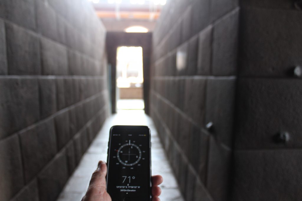
The solstice marking towers are no longer on the hillsides above Cusco, and the stone column is no longer in the centre of the temple. But the beautifully constructed stone walls at Coricancha are still there, preserved within the Dominican convent that was built over them. They display some of the finest Inca stonework in existence, and there are four complete rooms. Between two of the rooms is a narrow corridor, aligned on a bearing of 66.7 degrees east of north.
The stone column in the temple may have been an Inca intihuatana, “hitching post of the sun”, thought to have been the focal point of a ritual, a mass, a religious service where the Inca, the all powerful hereditary leader of the empire who was himself a child of the sun, made the sun stop in its regression northward at the summer solstice and begins its return journey to the centre of the sky.
There was said to be an Intihuatana in the main square of every Inca town, which would suggest up to a hundred or more, of which just a handful – at Machu Picchu, at Pisac – remain. The Spanish destroyed them.
Garcilaso says “the Governor of Belalcazoar destroyed all of the columns in the Quito region, because they encourage idolatrous practices…and the other Spanish captains did the same in the entire kingdom.”
The Machu Picchu Intihuantana – the Spanish never found the mountain-top ritual centre to destroy it – is located on the top of a steep sided hillock, built up with walled terraces, itself on the saddle of a mountain. The stone stands in the centre of a small patio, with stupendous open views on all sides, but particularly towards the rising and setting sun. One narrow staircase rises from the south and another descends to the north. It is a spectacular, theatrical setting. Only a select few, a dozen or two, would have been able to climb the stairway to stand on the narrow patio surrounding the stone.
Garcilaso left Peru for Spain at the age of 21, and was writing from memory. What he remembers was based on the stories told by his uncles, and recollections from his boyhood in Cusco. Another chronicler, Fray Bernabé Cobo, gives us much more detail. Whilst Garcilaso Inca tells us little about the Inca knowledge of the stars, Friar Cobo suggests that the indigenous people recognised at least a dozen celestial objects.
His Historia del Nuevo Mundo was written in 1653. “All the shepherds respect and make sacrifices to what the astrologers call Lira, which they call Urcuchillay, which is to say a multi-coloured carnero, which looks after the conservation of stock; and other small stars which are below in the form of a T, said to be the feet and the head…they also venerate another close by called Cantachillay, which is is also large, and another smaller one next to it, which they consider to be a llama with its cordero which proceeds from Urcuchillay.”
“Those who live in the mountains and the yunca lands, worship and sacrifice to another star they call Chuqichinchay, which is said to be a tiger and is in charge of all the tigers, bears and lions, they ask in the sacrifice that these beasts do them no harm. …Also a large number worship another called Machacuay, which they believe is responsible for the care of serpents, snakes and vipers, primarily because it appears in that form…they respect another star called Ancochinchay, which they say looks after the conservation of other animals.”
“In summary, for each species of animal they know a star in the sky, so there are many that they worship and have their own names and make sacrifices, those that they call Topatorca, Chacana, Miro Mamana, Miquiquiray, Quiantopa, and others, which include all of the stars of first magnitude, not one of which does not have its own name, as well as the morning and evening stars, and the most notable signs and planets, and although I have described them in general terms, for each of them they have their fabulous stories…”
Chankillo is a construction to observe sunrise and sunset across the year. The U-shaped mounds in the valleys of the central coast around Lima are oriented inland, up valley, and probably towards celestial markers. The Inca held rituals to recognise the sun at the solstice and the equinoxes, and also observed and celebrated other planetary and stellar alignments. Location within the landscape of the sky has been embedded in South American thought for five thousand years. Could the stones at Cochineros and the markings on them have some relationship with the sun or the stars?