From our lookout point at Pachacamac we see two ancient roads heading out from the maze of ramped pyramids below. One heads from the ancient complex across a dusty desert plain and through a gateway in a great adobe wall, headed directly for the ancient centre of Lima 27 kilometres away.
“A straight line following this road from Pachacamac will take us through the suburbs and straight to the cultural heart of spanish colonial Lima,” I tell Mayra. “It will pass by the Basilica de San Francisco, perhaps the second most important religious symbol for the spanish invaders, and head into today’s Plaza de Armas with the Presidential Palace and the Cathedral.”
“That’s right. The spanish chose, as they did throughout their American colonies, to erect their religious buildings on top of previous sacred sites,” Mayra concurs. “The centre of spanish Lima, the modern Plaza de Armas, was chosen because it had a canal running from the river to bring water to the complex of temples built there. The Cathedral, and Pizarro’s house, now the Presidential Palace, are built atop ancient temples. You can see the canals on paintings and drawing of the Plaza from the eighteenth and nineteenth century.”
“So the road from Pachacamac heads in a straight line to a ritual centre of the Lima peoples, built almost 2000 years ago.”
“Yes. Pachacamac began as a religious centre around this time, before the Wari came and buried their dead in front of the Old Temple, 1400 years ago.”
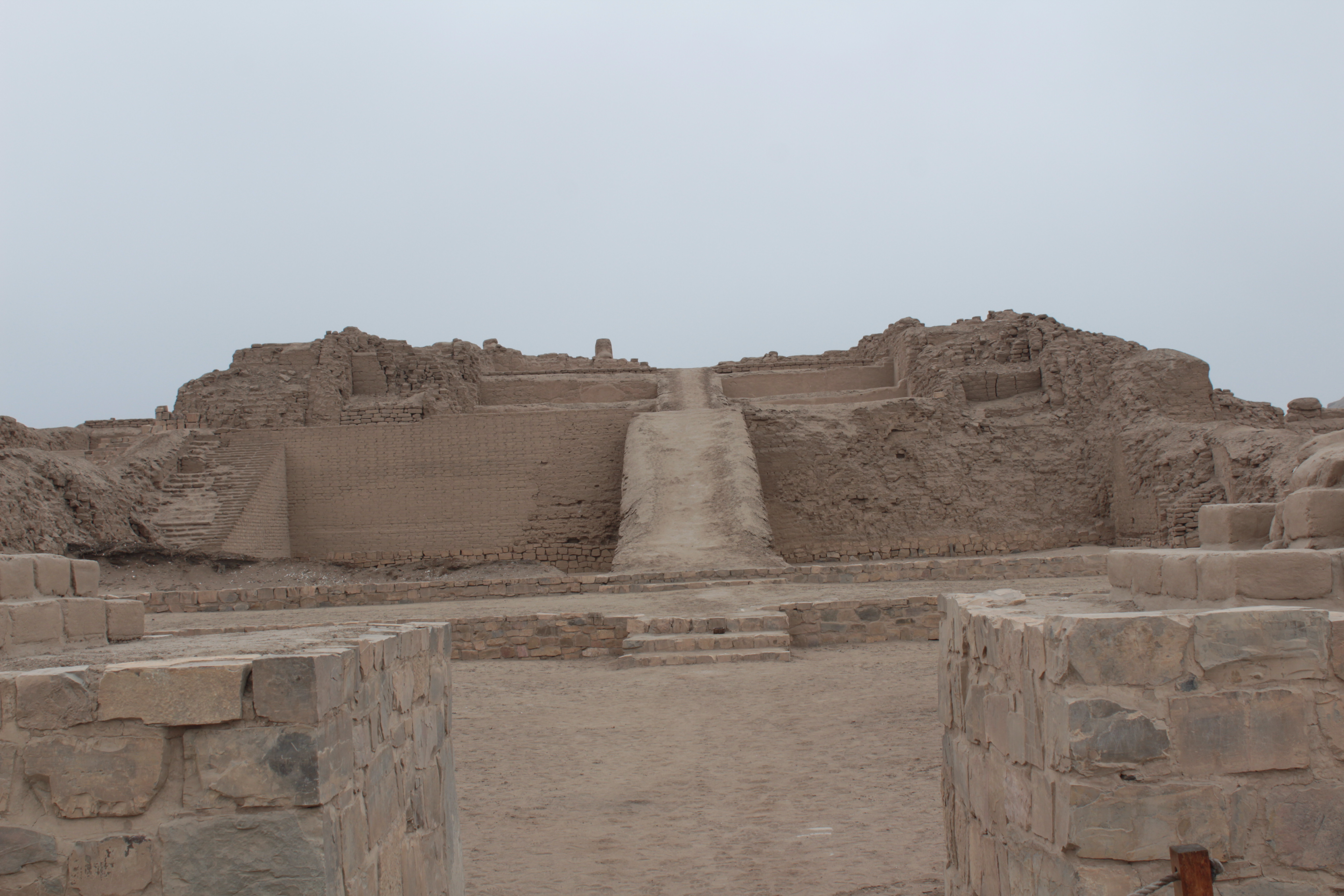
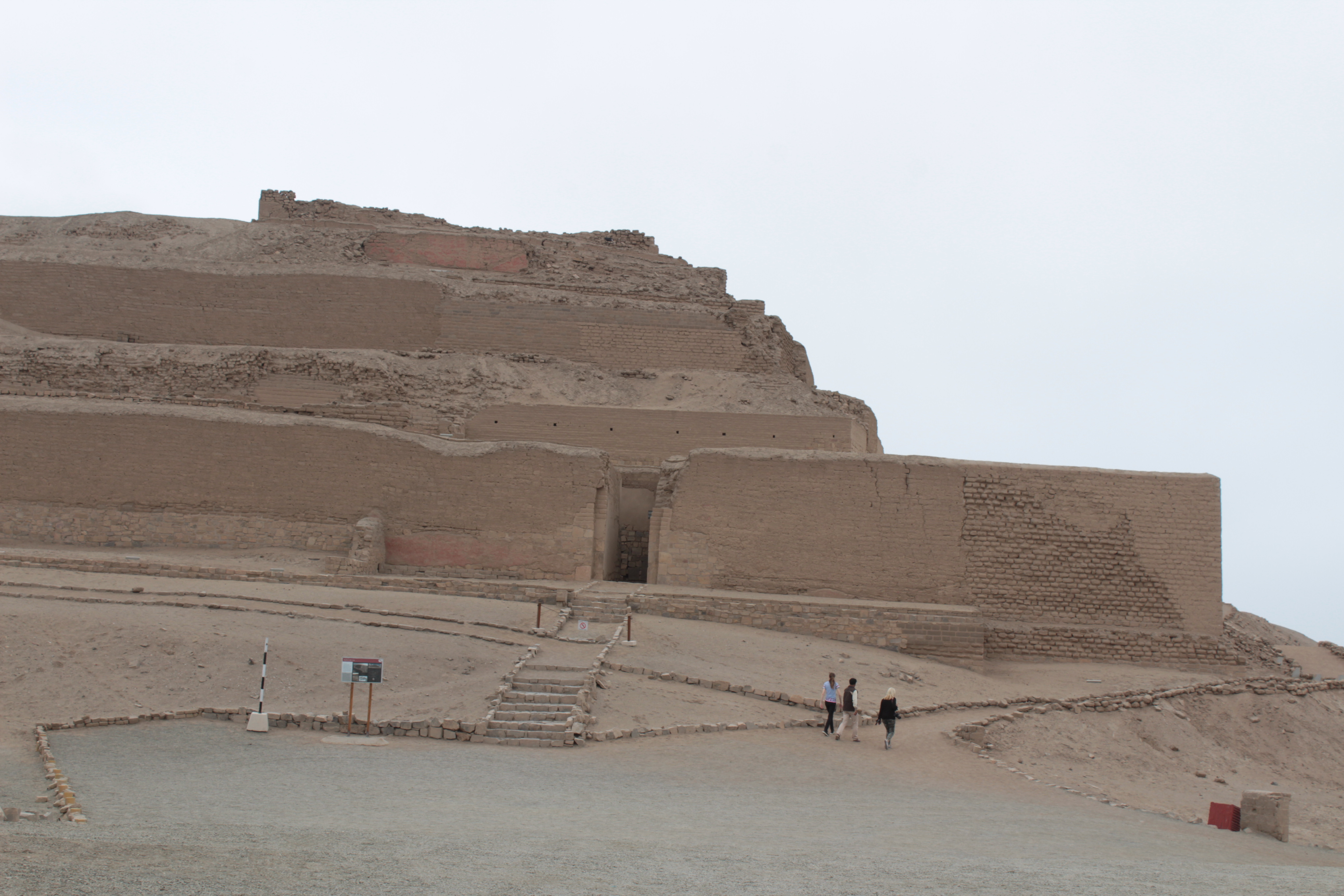
Standing on the walls of the Sun Temple we can see a second road that heads inland, eastwards. If we follow it in a straight line we will reach Jauja, 3300 metres above us, a major centre for the Huanca people, who were conquered by the Inca only a generation or so before the coming of the spanish. But the road up the Andes does not go in a straight line. It follows the valley of the river Lurin before climbing past Paria Caca, the sacred peaks, and continuing to Cusco. Pacha Camac was such a powerful shrine for the coastal people that the Inca wanted to incorporate it into their pantheon. The eastward road built by the Incas was designed to join the spiritual centres of the coast and the Inca empire, Pacha Camac and Cusco, by way of Paria Caca, a major deity of the central highlands. Thereafter the Incas sent annual tribute of sacrificial llamas to the coastal shrine, just as they made their sacrifices in Cusco. They also arranged for tribute to Paria Caca. The llamas most likely walked the same road, which stills winds past Paria Caca in a staircase of paved stone.
The modern road cuts inland past the pond where all the fishes in the sea originated, past the red terraced walls of the hilltop oracle where Pacha Camac foretold the future, the ramped pyramids of the Ychsma, the pavilions for the pilgrims, and the painted murals of the earlier shrines, and heads through a crowded narrow passage, where houses of borrowed wood and plastic sheets cling perilously to the hillside above the road, and chicharrón – roast pork – vendors shout at passing cars. It crosses a trickle of a river between high gravel banks, and opens out into the lower end of the Lurin valley, flat and fertile. By the roadside, sheep, alpaca and llamas chew grass in front of the car park for a “country restaurant”. The roads heads up the valley to the modern town of Pachacamac.
Pachacamac is a tiny town, three blocks by four, with a Plaza de Armas offset from the main road which continues up the valley. From La Molina, on the southern fringes of Lima, I would leave at the end of the school day and travel via three buses up over the hillside, to arrive in world of peace, as the sun was setting on a Friday evening.
But now I have come with Mayra. We stay in the only guest house in town, a series of rooms set around a central garden with exotic birds. It sits down a cobbled alley off the main road. But the main road has few cars in day time, and none after dark. This is a peaceful rural world just over the hills from one of Lima’s most wealthy and corrupt suburbs.
The peace is not eternal. We are awoken at dawn by the Amazon parrots on the garden, squawking at the rising sun, soon accompanied by screaming peacocks. But it is a relative joy to hear them at 5 am, replacing the abusive klaxons of Lima traffic.
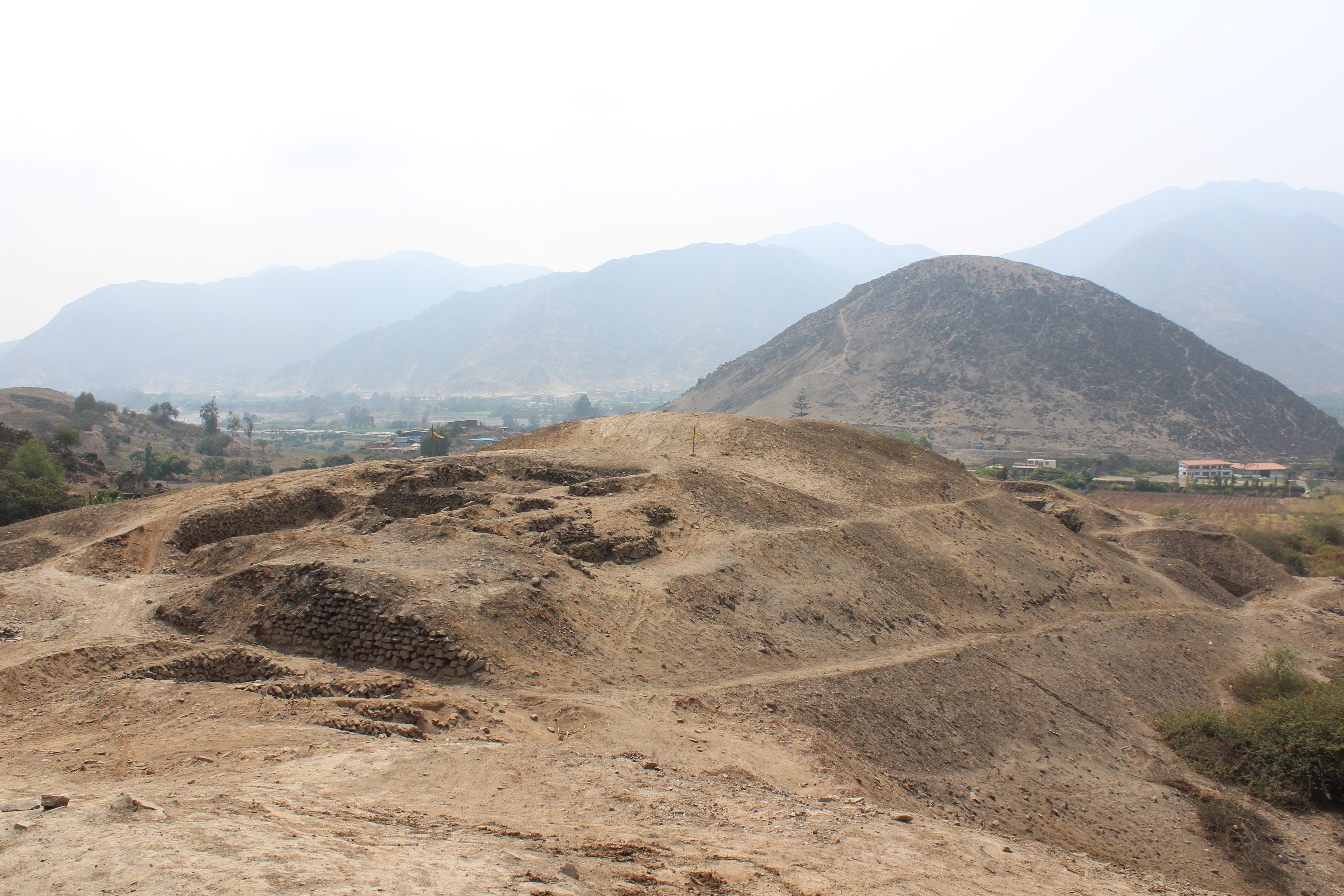
We find a small shop hiring bicycles and head out of town. The fields and farmland begin and in five minutes we reach Mina Perdida, a mound of broken black stone and dirt that tumbles down to the roadside. In fact the road cuts through the centre of this 4000 year old ritual centre, a “U-shaped mound”, the defining style of a culture which populated this and neighbouring valleys, long before the Pachamac site in its present form became a religious centre.
“I saw a map in the coffee shop” I tell Mayra, “that shows this U very clearly, two arms pointing roughly upriver, a higher central structure at one end, and an open central space. The map is dated 1955. The new road cutting through was built in the 1980s.”
Even more recently the western arm of this 4000 year old jewel of cultural heritage was demolished to create a flat space for new housing. The housing, the expansionist dream of a forgotten town mayor, was never built.
We climb up what remains of the U to a Catholic crucifix at the top. The mound was a massive undertaking, big enough to enclose several football pitches in the central space. It is four hundred metres across the base and the arms are each 400 metres long. Residential remains around the site suggest a population of less than three thousand, yet archaeologists estimated that the building of the mound would have required 100 people working for two months a year, for four hundred years. The ceremonial centre seems to have been used for five hundred years, from three and a half to three thousand years before the present.
“I have shown you the Lima cultures, and the Ychsma and the Wari, and their roads, canals and temple mounds in Lima” says Mayra. “They take us back two thousand years. And we can see that they had a continuity – they buried their dead or built their buildings atop their predecessors’ sacred sites. But these U-mound people were one or two thousand years earlier. This is the time of Stonehenge.”
We pedal on through an area of large walled residences, more estates than houses. The walls are three metres high, with massive gateways and small doors.
“Many of these would have been weekend retreats for the Lima rich,” Mayra tells me. “Some still are. It is prime agricultural land, irrigated by the ancient canals. But they grow no crops. Instead they have vast gardens and swimming pools, and employ a couple of locals to look after the children’s ponies, feed the ducks in the pond, and mow the lawns.”
Beyond the estates we are on dirt tracks between fields, with dusty grey-brown hillsides. Canals of fast-flowing water run besides the road or contour the hillsides above. We drop down with an open view of the valley to the left and then rise again, with a great round pudding of a hill in front. There are small rural dwelling places here, facing the road but with the fields at their back. Their yards are open and there are no security fences.
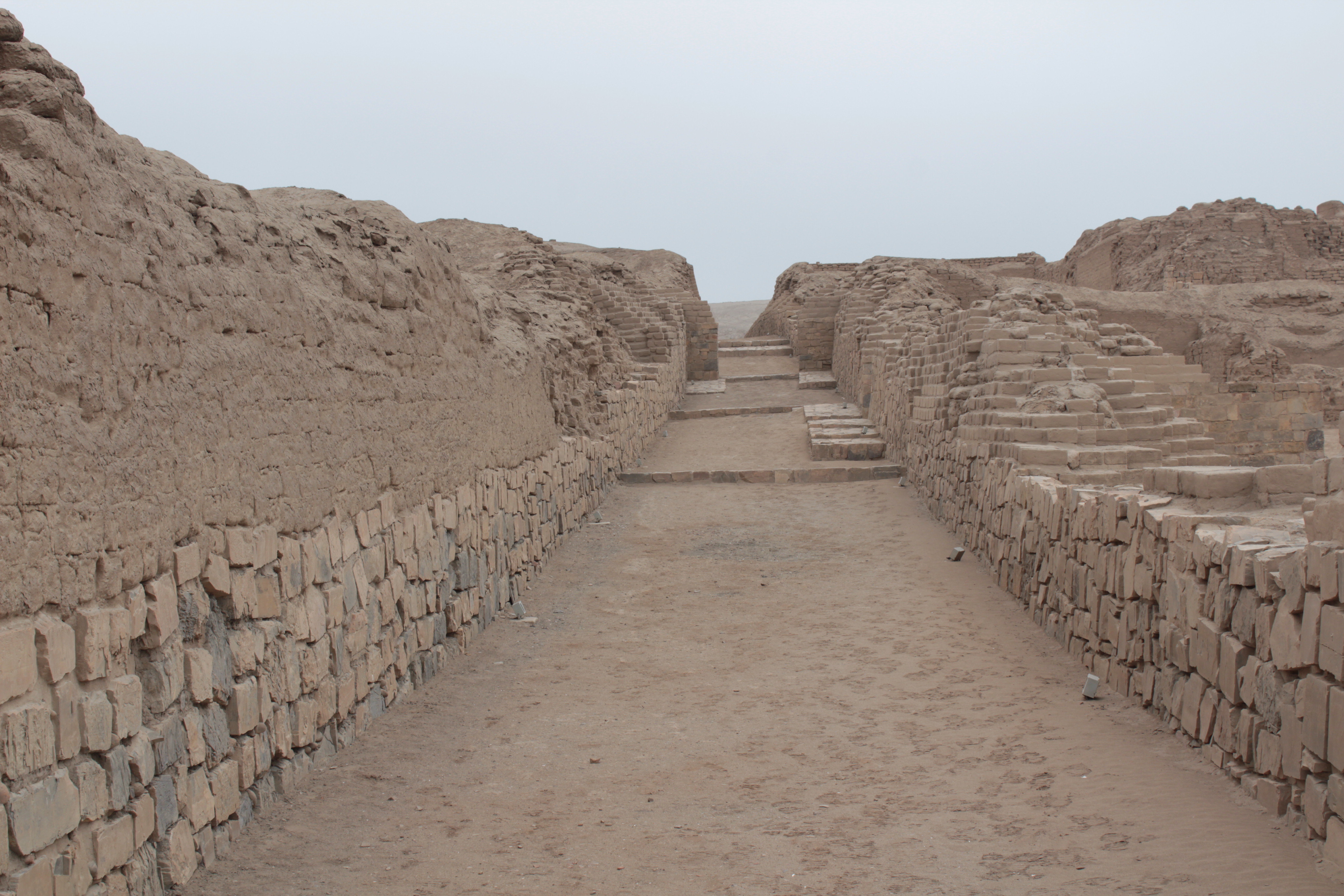
We lean the bikes against a wall and walk up a track by fields of onions and coriander. Ahead of us is Cardal, a well preserved U-shaped mound, with an irrigation canal running by it. We follow the children’s bike tracks up a steep slope and find ourselves standing on the top of a mound which is almost 20 metres high. In front of us is a giant plaza with side arms stretching out on either side. The ridge we are on is more than one hundred metres long, and the two arms reaching out in front of us are two or three times that length.
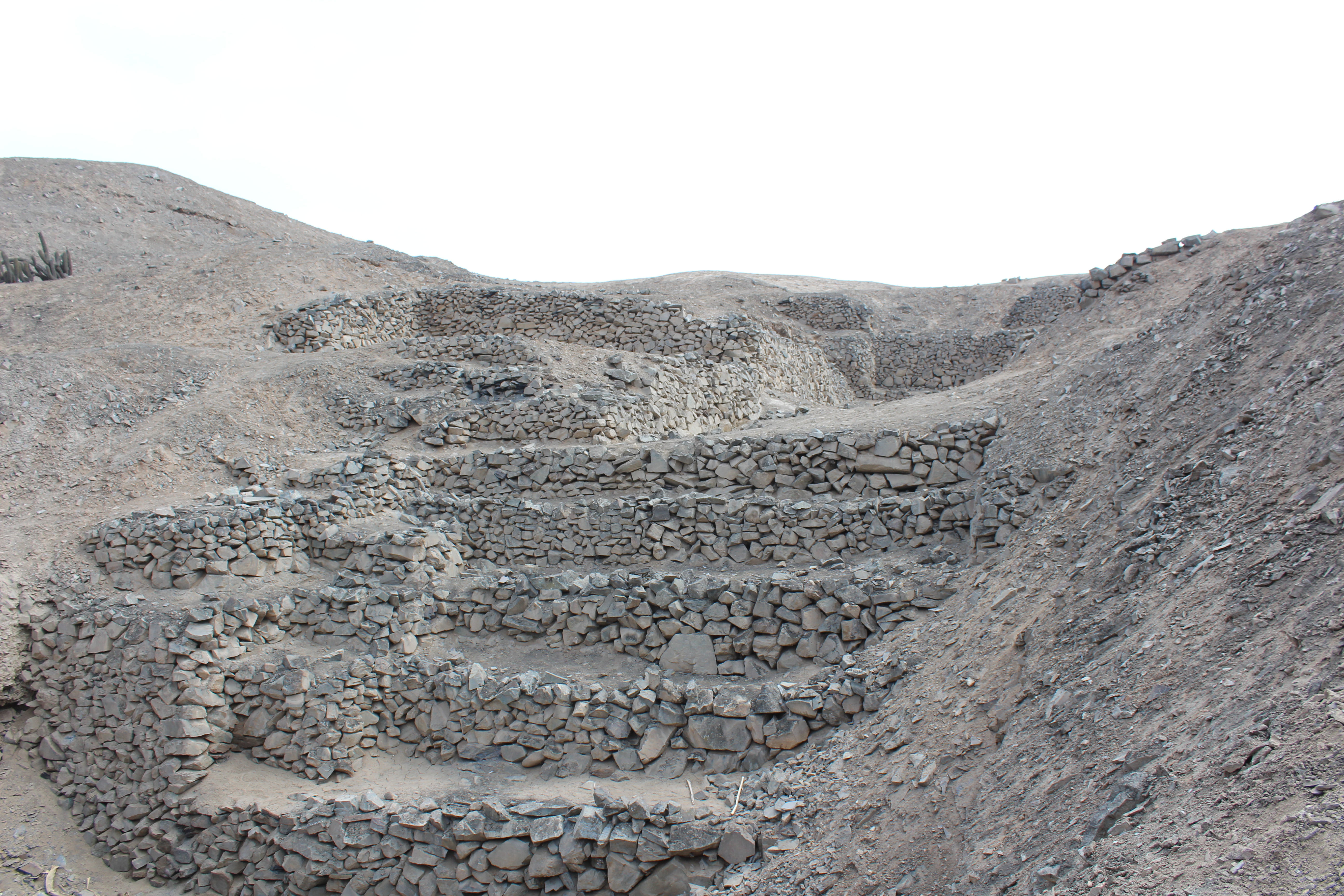
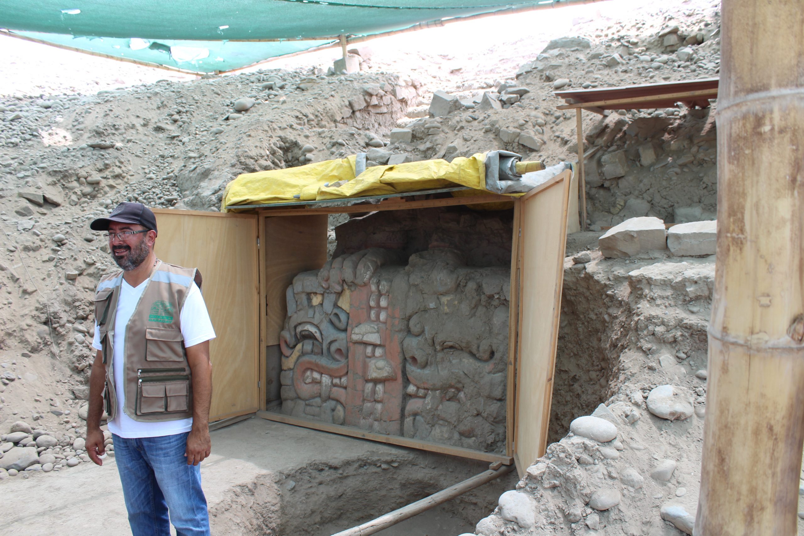
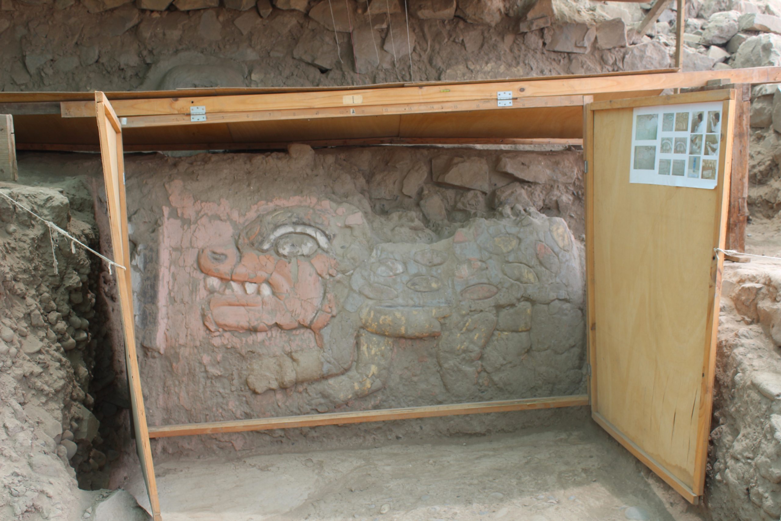
“Today we see dull grey mounds surrounded by farmland” Mayra tells me, as we stand on the top, “But these U temples had walls coated with clay and brightly painted in red and yellow. The front of the atrium here,” she points down directly in front of us, “had a multicoloured frieze showing an open mouth with sharp teeth, which was excavated and sketched and then covered over to protect it.”
“And from what we know – although many are unexcavated and others are destroyed – these were giant, brightly decorated structures, with courtyards to house tens of thousands, when your islanders were sticking up a ring of bare stones.”
“What were they depicting, with these mouths and teeth? What was the message?”
“Maybe it was similar to the Chavin cult, puma-eagle-creatures, maybe representing shaman transformation in a drugged state. Similar polychrome friezes, one showing a blue face, with red lips and white teeth, and blue mucous streaming from the left nostril, were uncovered at Garagay in the Lima valley in 1974. They were destroyed in the 1980s. But in 2017 they uncovered a long painted freeze flanked at one end by a fanged head, and at the other by a mythical creature resembling a crocodile.”
Looking out across the valley, flat fertile fields watered all year round by the channels from the river, we can see a third U temple on the opposite side of the river at Manchay Bajo.
“There were at least seven U-shaped mounds in this valley,” I say. “They began building Huaca la Florida, in the Rimac valley, four thousand years ago, and it was – it still is – truly enormous. The central platform is 350 metres wide and its wings or arms are 400 metres long, which makes it a concert venue or amphitheatre which could accommodate 100,000 people. It is a Hollywood Bowl, A Wembley Arena, a Bernabeu.”
” You’ve done some research!” smiles Mayra. “You think they held music festivals?”
“The dynamics of the space are the same as St Peter’s Square in Rome, or a concert stadium, people of privilege looking down on a multitude… it is the profile of power. But yes, there may have been music, and drug taking, and wild orgies. Or just eating too much and sleeping in late. It is Womad or Glastonbury.”
“Womad?”
“An annual music festival in Reading, UK. Woodstock, Burning Man, Lalapalooza, Selvamonos, I guess people are the same even over thousands of years, with or without iphones and lightweight tents.”
“But one thing is different” adds Mayra. “All these U-shaped mounds, like the mounds of Maranga by the zoo, like Huaca Pucllana and Pachacamac, are aligned somewhere east of north, a good many around 65 degrees, the direction of the rising Pleiades. So perhaps they are not watching Freddy Mercury, they are watching the heavens?”
“Several petroglyph sites – Miculla, Checta, Cochineros, Huancor – also have an open view up the valley in this direction,” I add.
We walk back down to the road.
Cardal stands above the road, at the upper margin of the irrigated zone. Between it and the river a great round hill rises, the Pan de Azúcar, Sugar Loaf. It features on postcards with an unusual rock structure high up on one flank, in the form of two lovers embracing. The Lovers’ Rock. Low down on one side is the Manantial, the spring, of eternal youth. A rare and special place on this desert coast.
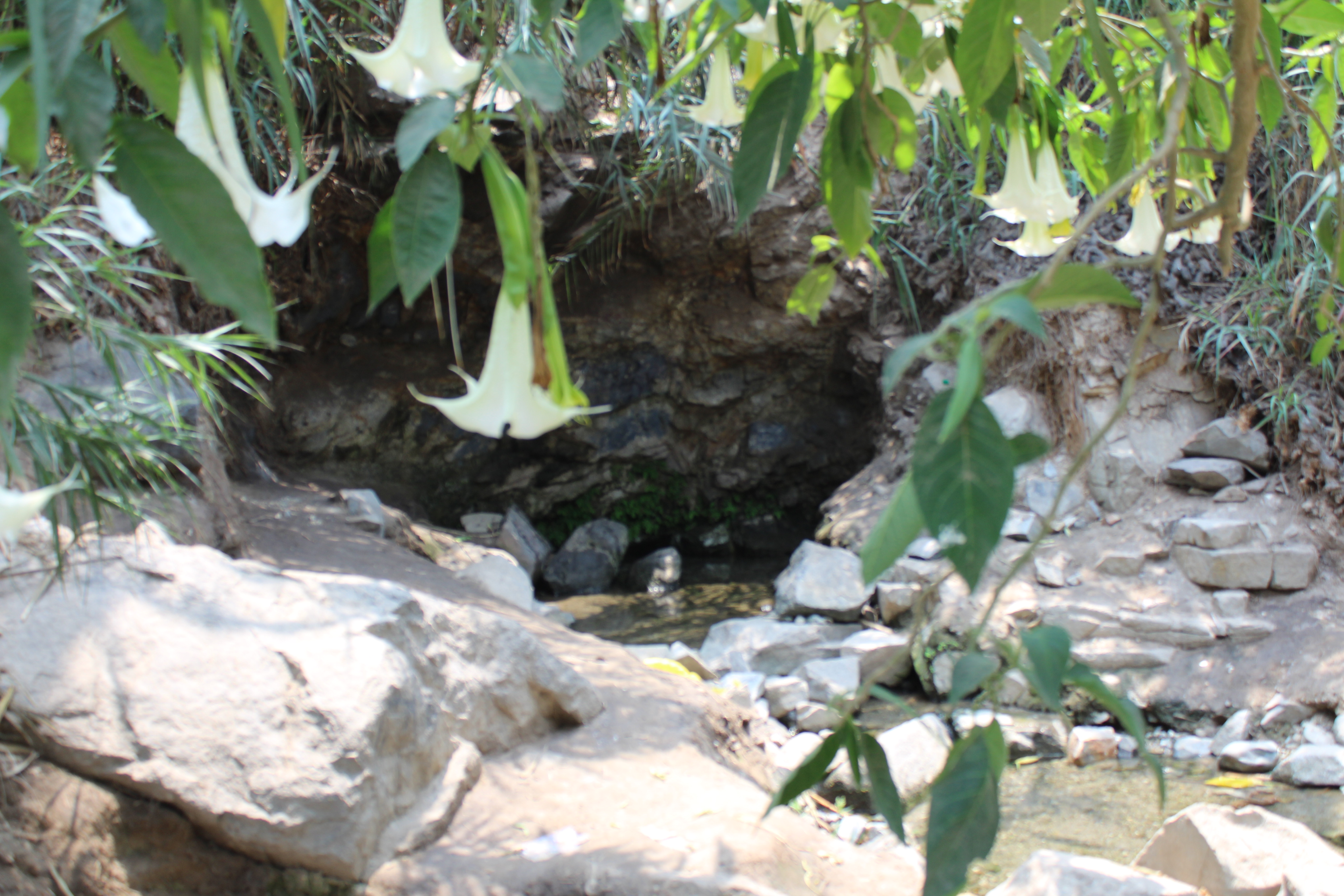
Wheeling the bikes down past a farmhouse and a sleeping dog we follow the white arrows painted on rocks to a narrow muddy track between overhanging canes only to turn the corner and find a young couple who do not want to be disturbed. Making our excuses we retreat, skirting the canes to descend on tidy stone steps to a still pool over sand beneath a rock outcrop.
A small stream burbles away downhill. The rock face is covered in small delicate names and dates of couples written in white marker, discreet and respectful, whilst higher up in spray paint is a U in a circle, the emblem of one of Lima’s leading football teams. As we walk back, another couple head into the thicket.
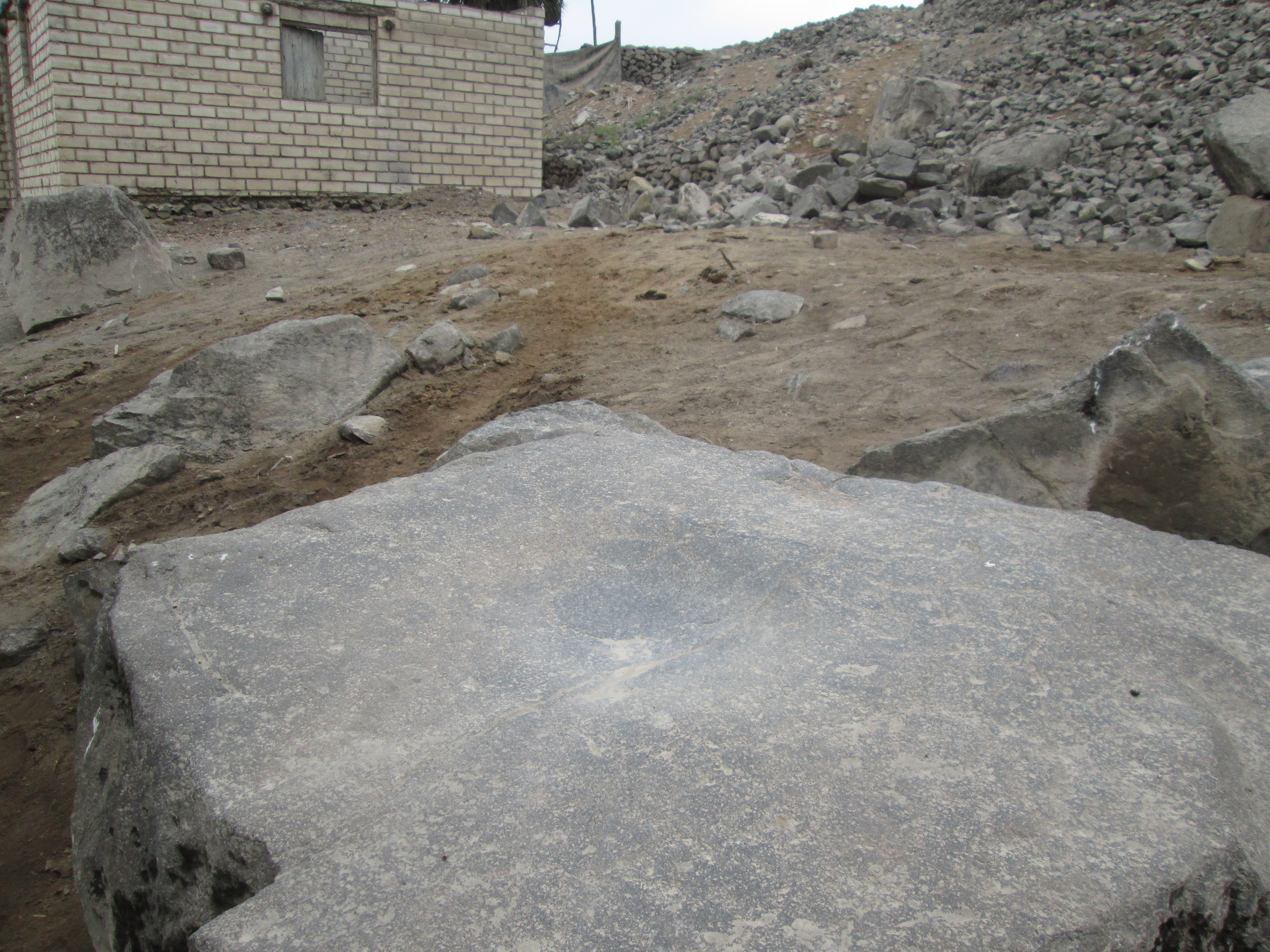
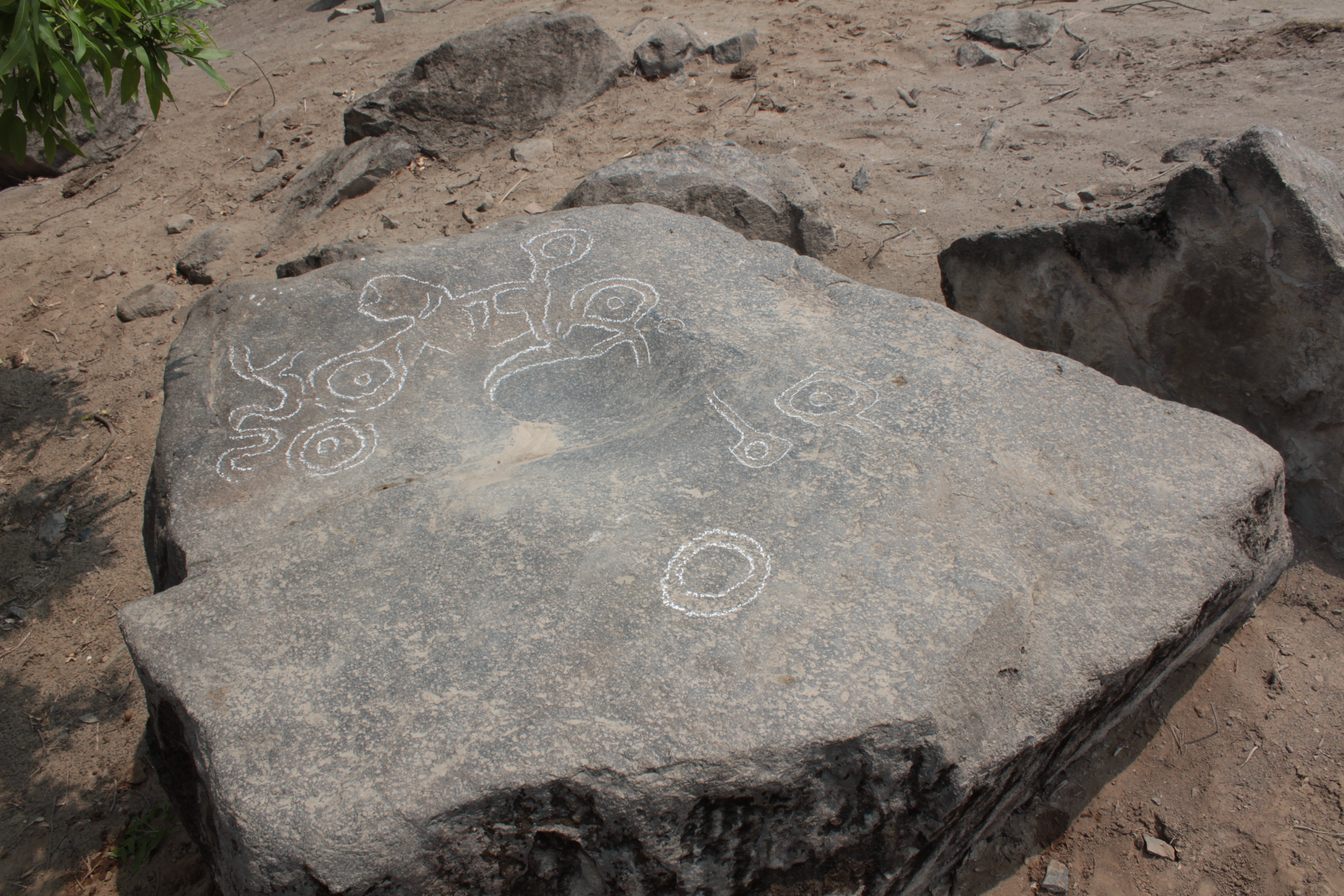
By the farmhouse there is a cube of black rock with a flat upper surface in the centre of which is a polished round depression.
On the surface of the earth around the stone are huayruro, seed beads from the amazon, and a few bits of mollusc shell.
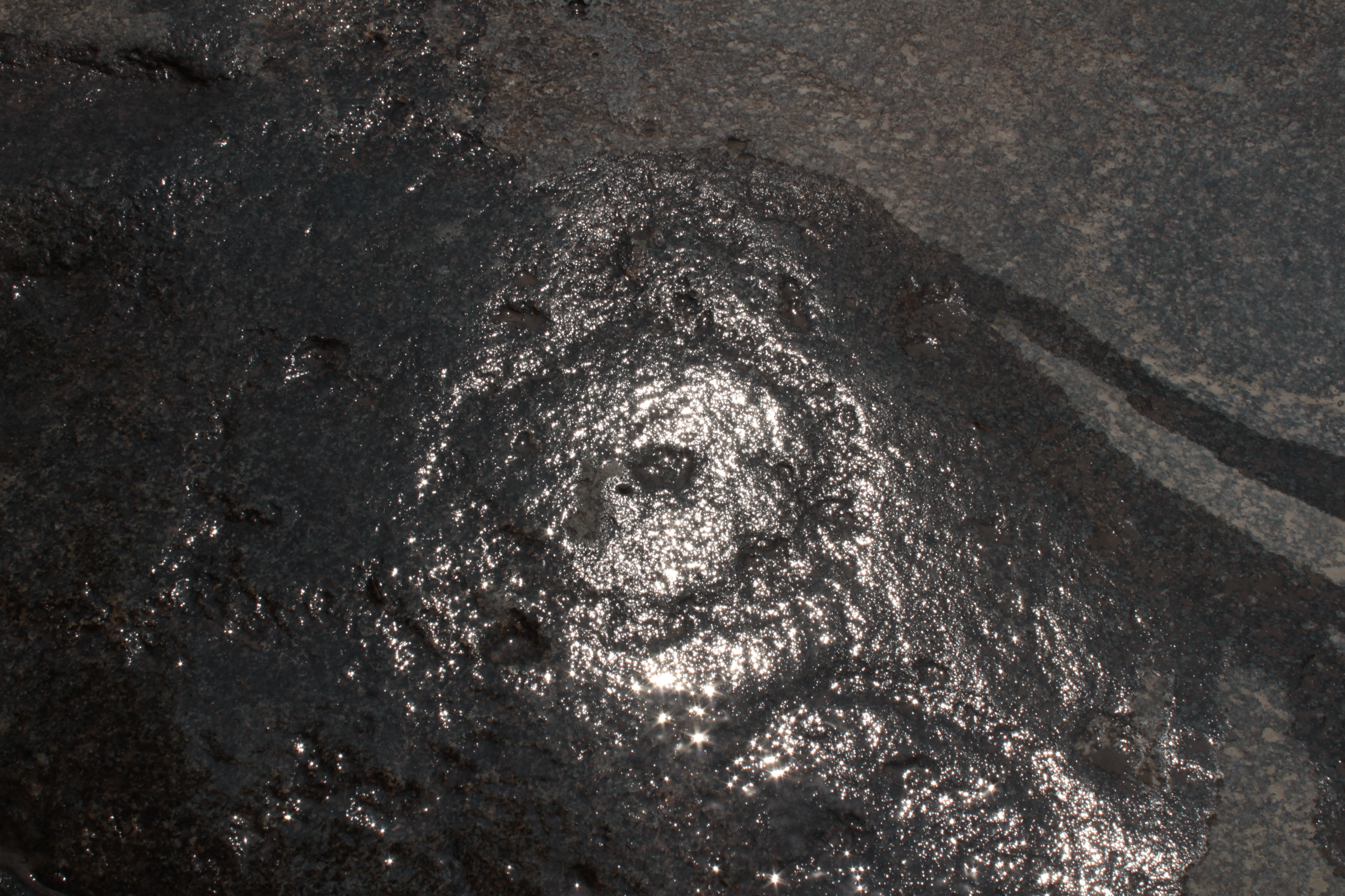
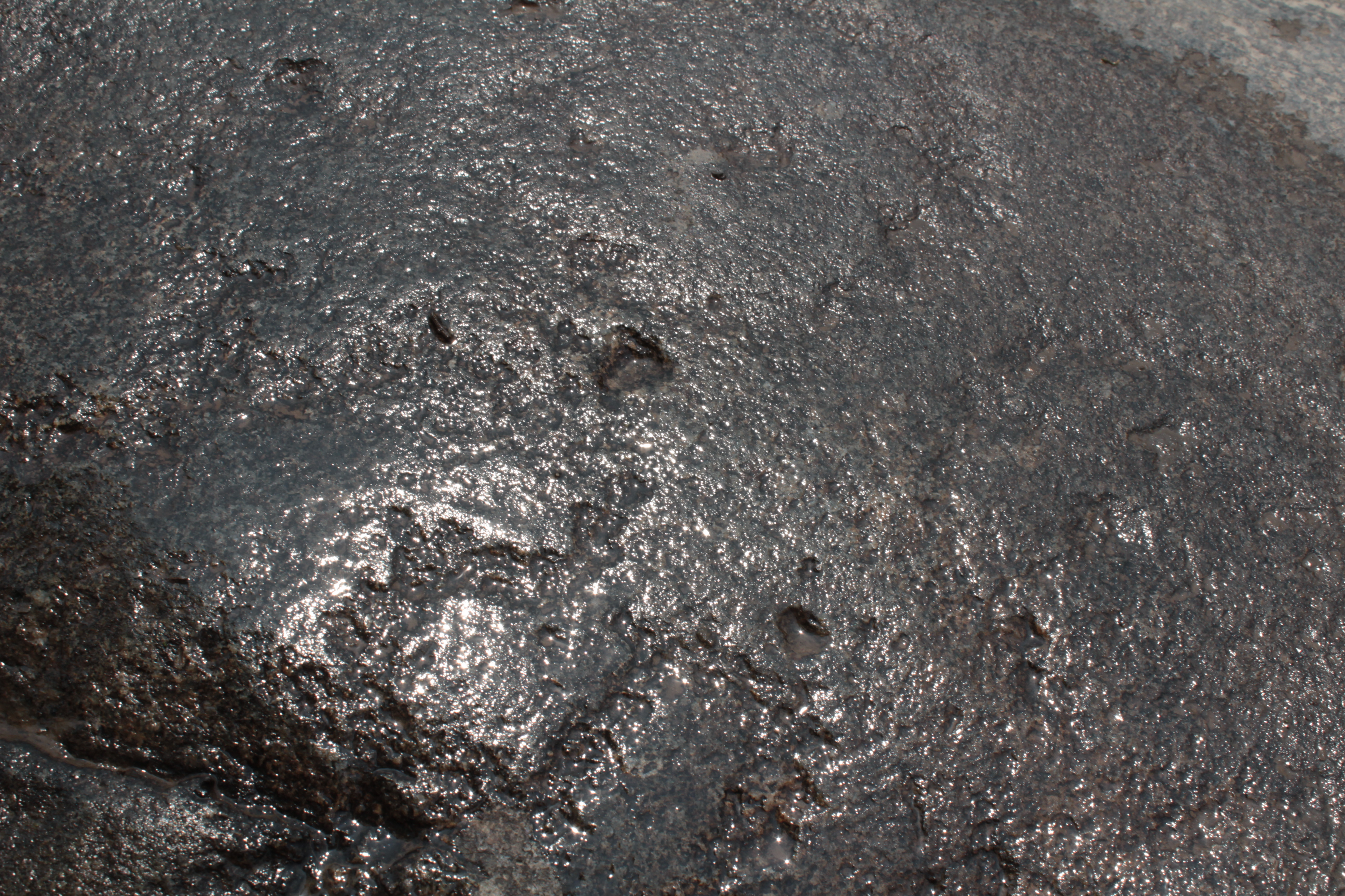
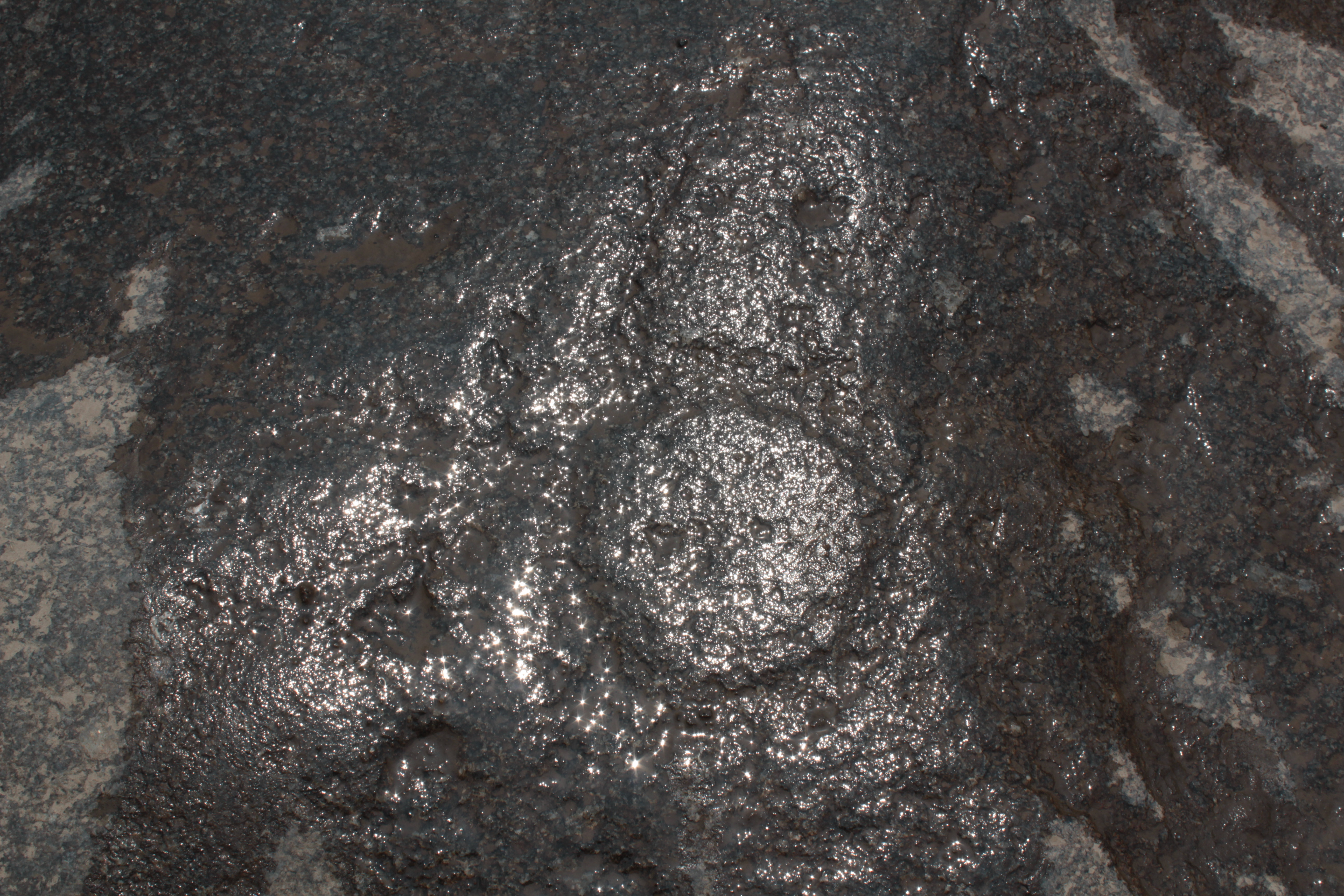
It could have been a grinding stone for the farmhouse, but as the sun sets behind the sugar loaf, we can make out faint inscribed designs. One or two circles, possibly a snake, maybe even a feline. There are markings here which suggest the stone and its grinding space are a good deal older than the house.
I take out my water bottle and drip it over the surface. With the sky reflecting off the surface I can see circles with central dots, and serpent shapes.
As I crouch over the stone trying to make out the images carved in the surface, Mayra calls out.
” Look! Its a spondylus!”
She has spotted a tinge of pink in the dirt, and bends down to pick up a fragment of sea shell, the spiny oyster, Spondylus. This is the food of the gods, grown only in warm tropical waters far to the north, and an important offering from the coast to the highlands.
As we cycle away, another young couple are walking down to the Spring of Eternal Youth.